The forgotten civilization, and the birth of hieroglyphs.
 |
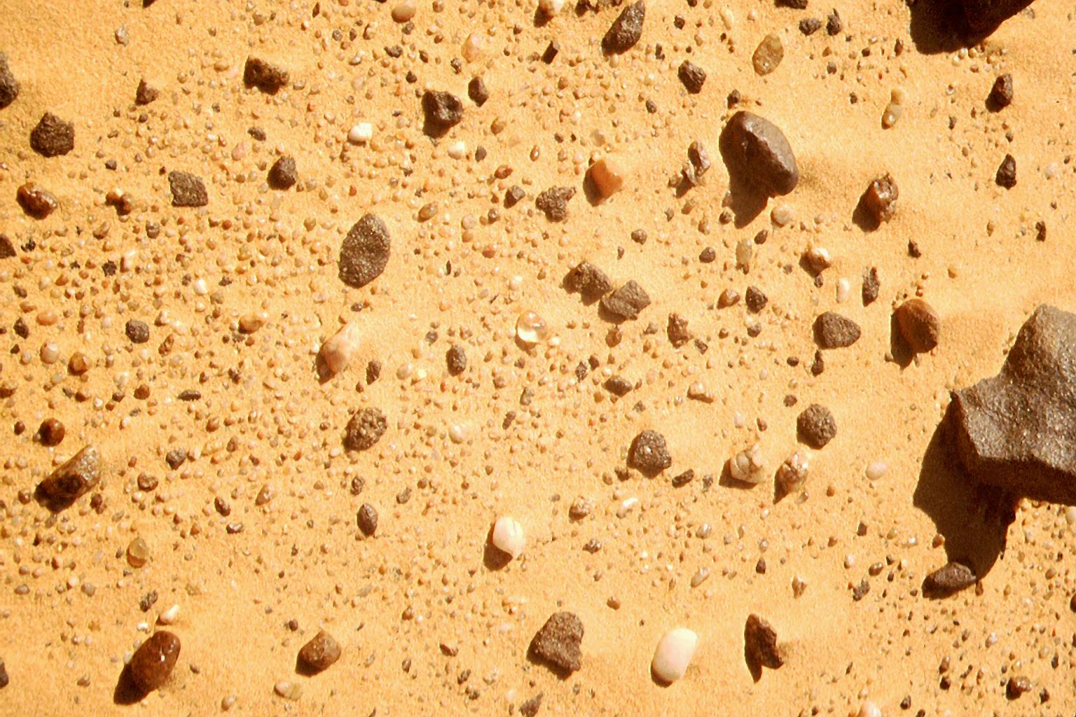
| Landsat satellite picture of the dunes of Saad Plateau, resolution 100 m. |
As you can see from the satellite the Northern part of the Gilf is totally engulfed by the Great Sand Sea. This is a formation of dunes between 50 and 100 m. high which is near impassable by an offroad. For better or worse all 12 of us had to push our cars on scales, and follow them on foot, till we reached an interdune corridor: it had taken the best of a day to do some 15 km.
The GSS is the largest extention of dunes in the world, with the Taklamatan desert in China. For centuries the GSS had prevented exploration of the remotest reaches of Egypt, giving rise to legends such at the Lost City of Zerzura.
 |
| Exiting the Gilf - Picture by Georg Zenz |
 |
| Marc trying to keep abreast with our Landcruiser, by me. |
The day after our departure from the Gilf, I showed Andras on the map the old coordinates of where Patrick Clayton, and Dr. Spencer some 70 yrs before had discovered the glass strewn fields.
In fact Andras steered the Landcruiser convoy by the readings of the GPS receiver only, with no need of maps.
Suddenly there we were, in an interdune corridor, all spread with pebbles of the most various colours. The glass pebbles, if any, seemed lost among them. But by walking in rows, in a scanning mode, never leaving eye contact with the ground, Georg and I soon begin to score, with findings of the precious glasss that had graced Tutankhamun's necklace.
Green-yellow, extremely viscous, and yet clear and hard, with wisps of dark dust trapped inside, it is clearly a matter generated in a cosmic explosion. I later discovered in the evening that if you hit two chunks together it will make sparks, i.e. it is triboluminescent, a feature that must have caught the imagination of the early stone splintering cultures, thus giving it a magical aura.

One day later by the remnant of a thermal lake, I discovered a lovely arrow head in sculpted glass, that might have had a ceremonial role in the Propitiation of the Hunt - as a vector of the sun arrows (See Leo Frobenius).
 |
| Hanna on top of a Mud Lion (Thermal Lake) |
Note that to this day an ejecta crater for the glass has not been found. Farouk El Baz of NASA's remote sensing facilities detected in 2007* a v. large one between the Gilf and Libya, he christened the Kebira crater, and made the assumption LDG might have come from there. Indeed nearby the glass is strewn for 6500 sq. km. Later analysis by samples collected at Kebira showed however that the signature between the crater matter and the glass is different.
 |
| A Kebira Crater's picture, seen from man's height |
According to Wallis-Budge 'Egyptian Magic' the scarab over the heart of the Pharaoh had a protective aim. The heart was the seat if the Ka the soul that transmigrated into immortality. The Egyptians might have considered that a green-yellow stone of cosmic origin was a good candidate to protect the Ka, and to sculpt the scarab with. Again a solar symbol, since the scarab rolling its ball of dung is a symbol of the resurgent Sun, and thus of the soul of the immortal Pharaoh. (W. Budge, 'Egyptian Magic')
After having spent a night by a prehistoric circle of stones, we reached the next stage on our return trip, Abu Ballas, Pottery Hill as it had been dubbed by English explorers in the 1920's.
 |
| Our Landcruisers at Abu Ballas, one of us is on top. |
The conical hematite red hill is entirely surrounded by jar fragments, going from Pharaonic to Roman times. This shows that it was a staging post for caravans. The jars were still in one piece at the beginning of last century when the Caliphe decided to have them destroyed so they couldn't act as a water depot for raiders coming from the South (Tibesti raiders, Libyans) who had preyed on the oases, up to Dakhla.
 |
| Abu Ballas in the 1930s. Jars are still whole. |
 |
Abu Ballas today, everything is broken. |
Indeed one of the remarkable findings at AB is a Libyan warrior of Pharaonic times, next to some hieroglyphs. There is also a little cave whose entrance is prevended by a seal of the German Henri Barth Institut, which is doing research there. To them is also due the exploration of the so called Abu Ballas Trail (more about it later). One of them, Kuhlmann, speculated that King Tut's glass might have been traded there by the fellows of the Libyan warrior.
 |
| Libyan Warrior at Abu Ballas |
It dawned on me that from times immemorial the road of Libyans invasions might have gone from Khufra Oasis to the Gilf and hence to Abu Ballas by making use of the last water sources, and depots of jars.
Keep in mind that at the Uweinat three borders meet: Chad, Libya and Egypt - as shown there by some ruined iron military structure - but we had crossed the borders, various times insouciantly.
Keep in mind that at the Uweinat three borders meet: Chad, Libya and Egypt - as shown there by some ruined iron military structure - but we had crossed the borders, various times insouciantly.
 |
| Picture of Zayed and Salama at Wadi Bakht, |
I climbed to the top of Abu Ballas, with other fellow travelers to have a breath taking view of the road behind us, and of the receding dunes of the Great Sand Sea. Next to me was Salama, fumbling with something on the ground, with a large smile. He presented to me what looked like a long piece of wood and encouraged me to touch it, without releasing it.
I complied, and I felt it was alive. At the same time I saw that Salama was holding a head with eyes and a wispy tongue. A snake! A long beige body made of scales, with a white belly. To this day I don't know it it were a local adder, of the same kind that bit Cleopatra! Salama broke in one of this neighing laughs, as if it were a good joke.
I complied, and I felt it was alive. At the same time I saw that Salama was holding a head with eyes and a wispy tongue. A snake! A long beige body made of scales, with a white belly. To this day I don't know it it were a local adder, of the same kind that bit Cleopatra! Salama broke in one of this neighing laughs, as if it were a good joke.
 |
| Salama and the snake he is offering me. |
On our return way, along the military tar road to Dakhla oasis, nothing remarkable happened, except that we were caught by a khamsin while we were dining between the calcium formations of the White Desert. It was ending badly, as it had begun. By dinner time, looking for camp with no possible fire, I would have lost my way in the sand blizzard, if energetic Andras had not caught me in time.
 |
| Our Toyotas in the White Desert, as the khamsin is beginning to blow. |
Where is the camp do you know? - he asked with a little unassuming smile. I pointed into the deep haze. He laughed at me. 'rather it's there' he pointed in the opposite direction. By going into nothingness, I could have died, such is the Khamsin. Nothing is ever far in Egypt from the Desert, the Land of the Dead, as it is called.
The morning after, still shuddering at the risk incurred, I looked at the jerrycans on the rooftops of the Toyotas, and asked Andras: 'They look all empty, is that what they are?' 'Yes, he answered, all we have left is a box of mineral water bottles'.
This is a testimony to the exact planning of the expedition leader, which I hadn't suspected. Chapeau!, as they say in French.
I enjoyed all the more a couple of iced cold beers, with the group in Dakhla Oasis, the same afternoon.
*
For some years after this foray, I tried to keep abreast with the other expeditions, progressively shifting my interest from Geology to Archeology.
Information trickled slowly, the main issue being how far Pharaonic expeditions had pushed into Africa. It was known that from time to time they had procured precious minerals, and Elephant tusks for the ceremonial needs of the Pharaoh and his court.
But these could be temporary things, no Pharaonic inscription was known in the Gilf or the Uweinat.
I even discussed what might have happened with Barbara Barich, head of Archaeology at Rome, Uni and former head of mission at Dakhla.
She mantained that nomad Saharans had fluctuated between the deep wadis of the Sahara and the Valley of the Nile, according to climate and water fluctuations.
The Henri Barth Institut, the German mission there, however remained far more dismissive. One thing were the (savage) Libyan tribes, another the Egyptian civilisation on the Nile. The only way to allow intermittent contact had been the fragile Abu Ballas Trail. The posits of classical Egyptology didn't suffer to be revised. Pharaonic Egypt was the son of the Nile.
 |
| Foerster map. Abu Ballas Trail, and archaeological sites. |
The real discoveries came after a few years. While Sahara specialists were still discussing how LDG, that precious mineral might have reached the Pharaoh, Carlo Begmann a self taught archaeologist, was exploring with his camels during a decade the many parallel paths connecting Dakhla to the Gilf Plateau. He did it on foot, and I can only refer you to his findings.
Among the most extraordinary is his discovery of a military and trading post established by the Pharaohs deep in the Sahara.
In what he dubbed Djedefre Water Mountain (DWM) Carlo Bergmann found 'Watercastle' pictograms, and posited that those were the first hieroglyphs ever. I'll let him speak, Please help yourself to a map of Egypt like this, and look at the bifurcation, DWM is at the beginning of the Northern branch:
 |
| Map from Zerzora Expeditions |
I took some notes from Carlo:
"Among the many proofs that are emerging of an African origin of Egyptian Civilisation is the matter of how hieroglyphic writing was born. Carlo Bergmann, the German explorer, claims he has an answer. By following a line of cairns that departed from the pharaonic police station south-west of Dakhla he found a stone temple, a conical hill about 30 metres high and 60 metres in length. “On its eastern side there is a natural terrace with an average width of 3 metres and a length of approximately 35 metres, about 7 metres above the ground and fenced by a dry wall of stone-slabs...
 |
| Djedefre Water Mountain by Bergmann |
"When setting my foot onto the terrace my eyes glanced over a breathtaking arrangement of hieroglyphic texts, of cartouches of Chufu (Cheops) and of his son Djedefre, of short notes from stone-masons, of two figures of a pharaoh smiting the enemies and of enigmatic signs ("water mountain-symbols") evidently placed on the rock-face in willful order. All these engravings were depicted in the midst of representations of animals and human figures from Prehistoric and Old Kingdom times... In one cluster of "water-mountain symbols" closed vertical double lines with numerous horizontal strokes are incorporated...In two cases, the mysterious pictograms are connected with a "water-mountain symbol" respectively a double waterline. "
 |
| Animals and Watermarks, by Bergmann |
"After a second thought I interpreted the arrangement as a map. Dating most probably to Late Neolithic period the "map" shows 10 wells and a number of irrigated fields, two of them connected with a water-source.
"This map led me to Biar Jaqub where I (on two expeditions) identified the locations of all the wells. They and the surrounding area comprise an ancient "lost" oasis (Wilkinson´s 2nd Zerzura). The map, therefore, is the oldest one in the world...” Bergmann claims. Not only he boasts having found an ancient oasis which might have fed the myth of Zerzura, but also he detected there the origin of hieroglyphic writing:
“As proved by similar finds at Abydos (symbols of irrigated fields on tiny clay- or ivory-palettes) the representations used by pre-dynastic people for artesian wells and irrigated fields were, later, incorporated into the hieroglyphic language. Their being depicted at Djedefre´s Water-Mountain and at Biar Jaqub, therefore, is striking evidence that the Western Desert of Egypt was one of the places where the development of the early stages of the hieroglyphic language took place... "
Hence, the area of Djedefre´s water-mountain and Biar Jaqub can be considered as one of the possible birth places of the hieroglyphic writing system. The author believes that at the end of the Neolithic wet-phase (with the influx of drought-striken desert dwellers) these early roots of hieroglyphic writing were transferred from the desert to the Nile Valley.
 |
Blue parts are mini glaciations, i.e. dessication periods in the desert. |
We now have some very good proof that the first language must have been pictographic, at the very beginning of our Western languages, 7000 yrs ago when there were still hunting-gatherers roaming the steppes of the then verdant Sahara, and the Pharaonic civilization was still in its cradle.
Explorer Carlo Bergmann has done an impressive work of mapping the extent of penetration of Egyptian expeditions towards the Gilf, and the traces they left, thus providing an explanation about how LDG might have reached the Pharaoh (see below). But he also documented Egyptian penetration by donkey in the farthest reaches of the Sahara, by an accumulation of Water Depots along the Abu Ballas trail, and parallel trails.
All very remarkable, considering that even today, because of the hard conditions (30mm of rain/Year only) no deep expedition can survive for more than 15 days, since it must bring with it its own jerrycans of water and gasoline on the roof, and is therefore is limited by weight. That was the reason why research was delayed by decades, while most mysteries remained such.
Instead, by dropping transportation by car and reverting to the traditional desert animal, the camel, Bergmann multiplied autonomy, and at its slow pace, chances to spot archaeological features that had been missed by earlier car expeditions.
*
*
Warning: technical part. You can safely skip to the conclusion, if Egyptology leaves you cold, or you find the tale too long.
Below some interviews I had with Carlo Bergmann in 2005-2008:
Q: how did you come to discover the Abu Ballas Trail ? - the ancient highway connecting the Nile to the extreme reaches of Southen Egypt, the Abu Ballas Trail, in short ABT. Did your traveling by camel make any difference?
A: I came to discover the ABT because Abu Ballas had been found in 1917 by Ball and Moore and, later, the pottery there had been analysed and age-checked by a French archaeologist. He dated the pottery to Middle Kingdom times. This is a period where camels were not yet used as beasts of burden in Egypt. If donkeys were used there must have existed water-depots between Abu Ballas and Dakhla. These I wanted to find. As I found traces of the road itsself, there was the need to follow it further to the southwest up on top of the Gilf Kebir Plateau and into the vicinity of a mine-field. This is the place how far I got.
The travel by camel has the advantage of slow movement and precise observation of the surroundings. One can "read" the landscape and stick to the faint traces of old trails much better than travelling by car.
Q: how did you begin your explorations?
 |
| Begmann at DWM with neolithic inscription and a Watermountain one |
A: I began travelling by camel in 1982, after having graduated as an economist. [Note: he was a Ford's representative in Egypt] but I decided to change my life by taking post doctorial studies. I got in contact with an egyptologist by travelling to Sudan and Jordania to Sudan with camels and once there I got the Desert Fever… Now every year I spend 6 months in the desert, this is my life, you know.
I changed my job, what I wanted to do was more fulfilling and I could not believe from the beginning this Egyptologist idea that the Western desert of Egypt was empty land, the land of the dead and so on... I travel alone. It is impossible to do otherwise, you can get in such troubles otherwise, so I decided to do it on my own. I started my exploration from Dakhla.
Q: I am amazed that you could reach the edge of the Gilf Kebir from Abu Ballas alone on camel: more than 440 km!
A: I had portable water, sacks of beans... One travels slowly because when one finds out ancient remains, one cannot pass them. Often I wouldn’t get anything to eat from eleven in the morning to three or four o clock until the sun is low, and then one can see the profile, the shadows of the old trails. On the other hand you cannot see them at all traveling by car.
When not researching my average is 40-42 km per day on foot, with the camels behind me. If I see something then it is only 4 or 5 km per day, sometimes less. If I see the remains of a track, it is a privilege to find it, and one has to stay in the corridor and look for further remains. So one has to 'bite' into the track and stick to it.
Q: what do you mean by trail, what is there to see? Is there pottery?
Along the ABT I foud more than a thousand jars altogether, about a third were still complete, in different depots. (By comparison At Abu Ballas the archaeologists claimed there were between 2 and 4 hundred.)
 |
| Carlo Begmann on the Abu Ballas Trail |
Q: this means the there was a Middle Kingdom trail to the Gilf?
A: Yes, yes. At Abu Ballas they claim there is 6th dinasty material. At Bir Jakub, half way between Dakhla and Abu Ballas, there is some 6th dinasty pottery.
To the West instead it’s Middle kingdom and some is from Ramses the Second. There is also roman pottery.
Q: what is your assumption, a caravan to Libya or to Tibesti?
A: Well, Tibesti is the most probable place. Close to Peter and Paul craters there is a semi precious stone that could have been mined. It was used in old kingdom times to make beads. Abu Ballas trail could lead to it...But I have to continue my search behind the minefield.
At any rate one can see in part the trail (ABT). It is still there, not in the sand, but in the hard gravel...And it is 4000 years old. And you can see its beginnings at Superintendent Mery’s rock.
You see alamats (cairns), as road signs, they are all over the trail, at a hundred meters’ distance each. I found more than 7-900 alamat on this road. I got their GPS waypoints for some of them, but I couldn’t stop for all of them.
But the trail could lead to Chad for trade reasons as well, for elephant tusks.
Q: do you believe that the first Zerzura was in the Gilf as Almasy thought?
A: Well, Some say there are many Zerzuras... I called mine, the one I found (at Bir Jaqub) the second Zerzura. Wilkinson mentioned it as at two days’ marches, while the first one, at Wadi el Melik, is at seven days’ marches’ distance, in the Gilf.
Almasy’s one in the Gilf is OK because I saw trails leading to it from Dakhla oasis. There is no doubt for me that Almasy’s is Wilkinson’s first Zerzura, at the moment [at Wadi el Melik].
 |
| Count Almasy with waddan |
A: From Biar Jaqub there are about 5-7 roads leading to the West. One of them I followed up to the western fringes of the Gilf. It is marked by a few alamat and at places of rest one finds "Clayton Rings" (pottery devices to hold water in water jugs) which have been dated to late predynastic period. Because of these finds the road I followed must be very old.
I have not the financial means to explore the 5-7 roads further to the west. I would like to perform this work and I am in a position to obtain a permission for it, but I lack the money.
Most certainly, one of the roads will lead to LDSG-area. About 40km west of DWM I already found a windscreen filled with charcoal and some small fragments of LDSG.
Q: I thought it interesting if you could find a direct route from Dakhla to the Saad plateau. You mentioned a piece of silica glass found by archaeologists at Djedefre Water Mountain. Would this point to a road west to Saad Plateau - where the glass strewn fields are - from there?
A: Yes. it would lead from Dakhla to Dedjefre to the windscreen and then continue to somewhere, more to the northern part of the Gilf.
Q: Kuhlmann made two separate assumptions about Silica Glass: either it was prospected by the Pharaohs, or it was traded by the nomads with them.
 |
| King Tut's necklace, with a Silica Glass scarab at its center |
A: The latter could have happened at Bir Jakub because there are [ancient rock drawn] calendars there, and a water supply, or it could have happened at Abu Ballas.
You see it is my aim to find Pharaonic traces in the Gilf. I am looking for inscriptions there. Andras found what he considers a Libyan figure (in 2003) on the western side of the Gilf. It shows two naked persons, one has feathers on his head, which typical of Libyans.
 |
| the 'dancers' found on top of the Uweinat By Andras Zboray (you can find his most complete collection of rock art here) |
Now this is in contradiction to what egyptologist think. They used to think the Libyans were in the coastal district, not so deep to the south in this remote area of the Gilf.
If there are chances to detect settlements of them and charcoals, and one can date the material near the rock pictures, it would give a new fantastic insight.
One could get closer to an answer if the desert dwellers like the Libyans were supplying the pharaonic civilisation with the desert glass.
I would like to emphasise a point, however. That the Abu Ballas Trail consists of 4 different roads. One of them has been used recently, since camel bones have been found on it. But we also we have old representations which have been dated as Old Kingdom times.
So the road has been used for a long time. It does not lead to Khufra, as Almasy speculated when he found Abu Ballas, but further to the south west.
On the other hand DWM is situated at the northern end of Wilkinson´s 2nd Zerzura. In the German text on my website I have outlined why the Chufu-expeditions went there to fetch pigments. Because there was water available!
A line of alamat (cairns) is leading from DWM towards the West. And as shown in the film - 2nd German TV, 2001 "Unternehmen Cheops - Die Seidenstraße der Pharaonen" - archaeologists have found a piece of Lybian Desert Silica Glass - LDSG, at DWM. It has been checked by scientists. So there is no doubt about its quality.
Q: and then there is the question of the prehistoric ‘map’ at Djedefre WM. Did you retrace all of the wells? Weren’t they covered with sand?
 |
| Bergmann's map of the wells |
A: The wells are gone. You find playas on the lee side of hills. It’s a land of thousand hills. In this area the playa was up to nine meters high. Because of the region having dried out, maybe around Middle Kingdom, or New Kingdom times, the playa has been swept away by the wind. And the wells have been put - this is my hypothesis - into the playa, into the ground. And when the wind swept away the playa, it swept the boreholes of the playa as well. You only see a sign with a watermark symbol.. I checked the hill but I am not a geologist, and I don’t want to dig. One would want to get debris and find wells that are close to the signs on the flanks of the hills and drill into the sandstone, but I cannot do it.
 |
| by Bergmann |
Q: so the main proof are the playas corresponding to wells on the map?
A: not only playas but the water mountain symbol on the rock faces of the hills. At Djedefre WM you find eleven WM symbols in a certain order. Two of them connected with camels and irrigated fields. I had the idea that this was done on purpose on the rock face at Djedefre WM. And this could be a map. And so I went and Kuhlmann said: no, you are crazy, you’ll never find any. So I went around with my camels on 2 trips and found all these signs. It is a land of thousand hills between which you find small wadis with the remains of the playa, up to 9 meters high. And at the rock faces of ten of these hills you find the watermarks symbols.
I have talked to Miroslav Lama, a professor in Prague, egyptologist. He has analysed the WM symbols as a root of the old egyptian language. As Kuhlmann says it is a combination of mountain and water. It is a pictogram but it might be the root of a hieroglyph. The French have found one in Dakhla combined with hieroglyphic text from a person called Supervisor Mery.
Archaeologists from the Henri Barth Institut went at Djedefre WM and they found pottery sherds, ‘kitchen pottery’, and rock pictures of the oasis dwellers there - the Sher Muktar culture from Dakhla. These people were living in a symbiotic relationship with the first Egyptian people coming from the Nile valley, up to Middle Kingdom times. They could have been the [first] Oasis Dwellers.
Thanks to the pottery finds you have the first proof that the Oasis Dwellers were out there at the time, because they were in a layer where you found Old Kingdom pottery, of Djedefre and Cheops pharaohs. In Bir Jakub we were lucky that in addition to pictorial remains we had pharaonic text.
Q: but you say that the WM pictogram is found in asssociation with hieroglyphs also in Abydos, on the Nile?
A: Yes it was Dreyer's expedition digging there, at Umm el Kab, and he went trough all the rubbish material and found a small pieces of pottery and ivory tablets where you have these roots, before the pharaonic language began. And you among them thisere this irrigated field system, the same you have on Djedefre WM rockface.
 |
| By Bergmann |
The sign with parallel, crossed lines, is associated with a Sa Wadjet sign. Did Sa Wadjet (the Son of the Cobra) attach his name as a traveler to an older pictogram? If he had done it on purpose and drawn the irrigated fields perhaps it would mean that he was a peasant, doing agriculture at the time of the Middle Kingdom in Bir Jakub. This would be fantastic, but we should find organic material to date it in order to prove it, and I can’t do the digging myself.
Q: The origin of hieroglyphs begining at the very start of Pharaonic Civilisation was rather a mystery, was it?
A: yes but Dreyer with his work brought some insight in it. He found a list of king names of the First and Second dynasty in Abydos, on the Nile. The fields symbol is the same there and in Abydos. He found the root of a hieroglyph, a field's symbol, not the water mountain one. In Djedefre we have already a combination of different signs.
In Dakhla oasis you have the water-mountain sign without the ears on top. You have this kind of bucket with the waterwaves in it. And buckets like this are along the watermountain symbols as well at the different sites.
 |
| Photo of Watermountain with ears - the mountains. By Bergmann. |
Q: how did you do 440 km from Abu Ballas to the North of the Gilf?
A: In fact I did 1040 kilometres in a row the first time I was looking for the Abu Ballas trail, from Sudan to Abu Munhar. The camels then were very strong ones, and I conditioned them, in wintertime, not to drink and work hard for 18 days.
And I did about 43 km per day, in the average. I went from Bir Oju in north western sudan to Bur Tojur, then to the Djebel Uweinat, then to Abu Ballas, Regenfeld and Abu Mungar where I got water. It is I believe, a world record."
*
*
To recap, the discovery of the Silica Glass at the heart of the Pharaoh focussed the archaeologists' attention to the means that Ancient Egyptians might have used to connect such a distant region like the Gilf to the Nile.
From pottery shards with the drawing of a donkey, they guessed that they had used donkey caravans. Meanwhile Bergmann was discovering the staging posts of the caravans, with water depots and the hierogyphic roots inscribed there.
By checking the superposition of pharaonic signs and the Desert Dwellers' animal drawings, Bergmann realised the influence that the Desert Dwellers of the Sahara might have had on the early kingdoms of the Nile.
This led to the thesis of the recent book 'Black Genesis' (2011), that Ancient Egypt had its roots in African communities. Suddenly it was all the buzz for African internet navigators, feeling proud about the contribution of their black countries might have given to the oldest civilization, and the longest lasting, of the African Continent.
The book mentions Bergmann's pioneering work, but it's not all. In 2011 Bergmann went to an Egyptology meeting in Prague, where he published his results about these proto-hieroglyphs in a PDF, among the papers of the meeting.
Even before, his discovery of Djedefre Water Mountain had been published by a German academic review in 2003. It was at last public recognition for more that 20 years of solitary exploration.

Even before, his discovery of Djedefre Water Mountain had been published by a German academic review in 2003. It was at last public recognition for more that 20 years of solitary exploration.
His conclusion?
"Contrary to the prevailing opinion in Egyptology, it was not bureaucratic needs which facilitated the invention of a written language but rather, necessity per se (that is, the vital necessities of life itself). This event was triggered off in the Western Desert of Egypt by gradual degradation of environmental conditions which slowly began to take effect at the beginning of the Predynastic period, circa 5.000 BC.
[i.e. water signs were created by the need of Sahara Dwellers to label surviving water sources]
[i.e. water signs were created by the need of Sahara Dwellers to label surviving water sources]
"Thus, the precursor writing of the Pharaonic script which had resulted as a consequence of an adaptation process to climatic change, had already come into existence in the Western Desert of Egypt more than 1000 years before tribes, societies and/or (unknown) bodies of people, had developed their bureaucratic procedures & structures [in the Nile area]."
*
*
According to egyptologist Herman Te Velde, in a PDF at Groeningen Uni, the evolution of hieroglyphs was not unlike that of modern news. First Egyptians combined drawings of animals and people in a composition, then they added signs of sounds, resulting in what was a a relatively simple rebus to interpret.
Egyptians didn't invent the alphabet but a syntax of images, with labels. Exactly like we do with photographs today, when putting together a reportage.
One can also see an evolution from rock drawings depicting social ceremonies in the Sahara to the hundreds of hieroglyphs of the Nile that were needed to keep accounts of agricultural produce belonging to the Pharaoh.
The earlier animalism however never left the hieroglyphic writing, pointing to an earlier African origin.
Let me conclude, with a vision of what might well have been the Queen of Zerzura, taken more than 30 years ago in Timbuctu, on the southern edge of the same Sahara.
 |
| The Queen of Timbuctu, a Touareg nomad, playing a welcome song for her guests. |
To the nomads of the Sahara the desert has never been impassable.
Note
Where not otherwise stated, pictures are by me. The Interview with Carlo Bergmann is copyrighed to Giles Stanhope-Wright.
Here you have a quick course in hieroglyphs, a PDF, by Wallis-Budge, the early curator and father of Egyptology at the British Museum. Very easy to understand!


.gif)

